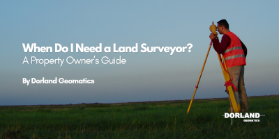
When Do I Need a Land Surveyor? A Property Owner’s Guide
By Dorland Geomatics
The Short Answer:
You need a land surveyor when you need to know exactly where your property boundaries,
buildings, features, elevations or other site conditions are, particularly before you buy,
build, renovate, install a fence, divide land or resolve a property issue. In Ontario, a
licensed Ontario Land Surveyor (OLS) is especially important when legal property
boundaries, severances, subdivisions or other cadastral surveying matters are involved.
Why It's Easy to Miss the Right Moment
For many property owners, surveying only becomes urgent when a question or problem
appears: a neighbour questions a fence line, a contractor needs accurate information
before construction, a development application requires additional site information, or
there's uncertainty about where a property boundary actually sits. But a survey is often
most valuable before the problem appears. It gives property owners and the professionals
working with them reliable information about the land before important decisions are
made.
When Do You Need a Land Survey?
A land survey can be useful at several stages of property ownership:
If you're buying or selling property, surveying can help establish boundaries and show
how buildings, fences, garages, driveways and other improvements relate to them.
If you're planning a new home, addition, garage or development, surveying can provide
accurate site features, elevations and boundary information for design and engineering.
If you're building, construction surveying can help accurately position proposed work on
the property.
And if you're considering a severance or subdivision, an Ontario Land Surveyor can
provide the legal surveying expertise and plans required as part of the process.
Matching the Survey to the Question
The right surveying service depends on what you're trying to determine. A boundary survey
deals with the location of legal property boundaries. Topographic and site surveying
captures existing features, elevations and conditions that may be needed for design,
engineering or development. Construction surveying helps transfer proposed designs and
positions accurately onto the site. Legal and cadastral surveying supports matters such
as property boundaries, easements, severances and subdivisions. You don't need to know
the technical name of the survey before contacting a surveyor. Explain what you're trying to
accomplish, and the surveying team can help determine the appropriate service.
A Simple Rule of Thumb:
If a decision depends on a property line, building position, elevation, development
requirement or legal property boundary, speak with a surveyor early. Getting accurate
information at the beginning of a project can help reduce redesign, avoid construction
problems, prevent boundary disputes and give engineers, architects, contractors and other
professionals better information to work from. Common reasons property owners contact
a surveyor include buying or selling land, building a home or cottage, adding a garage or
addition, installing a fence, checking a possible encroachment, dividing land, creating an
easement or simply confirming where a property boundary is located.
Why Professional Judgement Matters
The value of a land survey isn't just the plan or measurements you receive; it's the
professional judgement behind them. Establishing a legal boundary can involve reviewing
registered plans and records, locating survey monuments, assessing physical evidence,
completing field measurements and interpreting that information using professional
surveying principles. Small assumptions about where a property line or proposed building
sits can become significant problems once construction begins or a property changes
hands. Accurate surveying helps replace those assumptions with reliable information.
Why a Fence, Old Survey or Online Map Isn't Always Enough
One of the most common misconceptions about property boundaries is that an existing
fence represents the legal property line. It doesn't necessarily. Fences may have been
installed for convenience or without first establishing the boundary. An older survey may
still contain useful information, but it may not show buildings, additions, fences or other
improvements constructed since it was prepared. Online maps and municipal GIS systems
are also useful for getting a general understanding of a property, but they shouldn't be
relied upon to establish a precise legal boundary for construction, legal or other important
property decisions. When the exact location matters, a professional survey is the reliable
way to determine it.
Not Sure Whether You Need a Survey?
You don't need to know which type of survey to ask for before contacting Dorland
Geomatics. Tell us what you're trying to accomplish, whether you're buying property,
planning construction, dividing land, dealing with a boundary concern or preparing a
development project, our team can help determine the surveying service appropriate for
your situation. Dorland Geomatics provides professional surveying and geomatics
services to property owners, developers, contractors, engineers, municipalities and
organizations throughout Northern Ontario. Contact our team to discuss your property
or project and request an estimate.

When Do I need a Land Surveyor